Active Sunderland Cycling and Walking Map
27 September 2022
A new printed map aimed at boosting active travel across Sunderland has been launched.
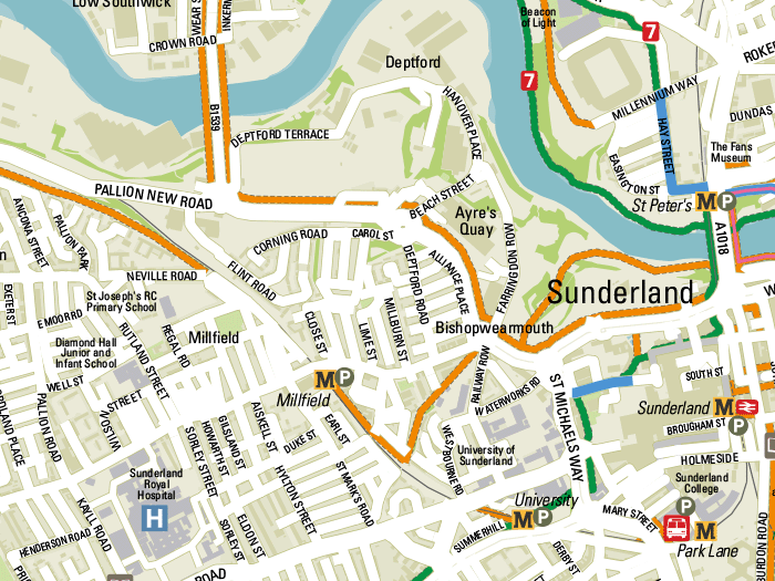
The map showcases Sunderland's 180km of dedicated cycle routes together with public rights of way routes for those exploring the area on foot. Four National Cycle Network routes converge in or cross the city, including the internationally renowned C2C. The route attracts over 20,000 long-distance cyclists every year, and locally it is an important east-west link connecting residential, employment and retail sites.
The City of Sunderland commissioned Pindar Creative to create the map using an existing map base drawn in 2021 for Transport North East. Pindar Creative advised on the most logical flat and folded size for the map, ensuring that it is economical to print while allowing the map to be shown at a legible scale.
A cover was created using Active Sunderland's branding and the scale bar shows distances in both miles and kilometres. A key allows users to easily identify traffic-free cycle routes, footpaths, shared paths, national trails and points of interest.
The map can be downloaded here, or an interactive version of the map can be found on the GoSmarter website.
Carl Thomas, Managing Director at Pindar Creative, said:
 We understand the importance of creating cost-effective products that are economical to update and reprint. We're delighted to have been involved in a project that will help residents and visitors explore Sunderland on foot or by bike.
