With you every step of the way
Working closely with you at every stage, our cartography professionals create maps and route plans to satisfy your specific requirements.
We will
- Recommend the most effective and innovative ways to proceed with a mapping project using the latest technology, including GIS
- offer advice about map publishing
- ensure your publication conforms to the appropriate accessibility standards
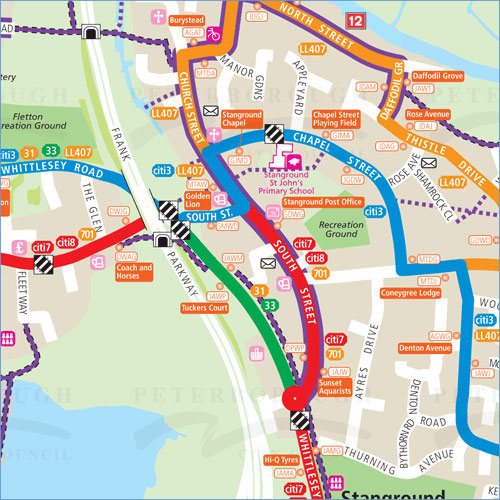 Example map : Peterborough.
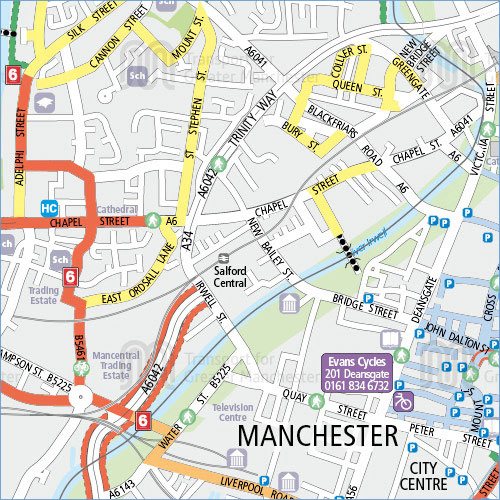 Example map : Manchester.
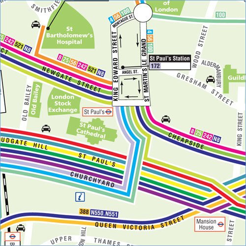 Example map : City of London.
Interactive and Printed Mapping
Our cartography product range keeps expanding and includes:
- County, Area and Local maps
- Travel Plan maps
- Cycle maps
- Walking maps
- Bus route maps
- Rail network maps
- HGV route maps
- Spider maps
- Pocket maps
- Parking maps
- Tourism and visitor maps
Maps for
- Transport Interchanges
- Shopping Centres / Retail Parks
- Universities / Colleges / Schools
- Large visitor attractions and Hotels
- Hospitals and health care facilities
- Recycling centres
- Stadiums
- Maps for Businesses
Local Authority customers include Buckinghamshire County Council, Durham County Council, London Borough of Hounslow, Peterborough City Council, Shropshire County Council, Kent County Council, West Sussex, City of York Council, Coventry City Council and Swindon Borough Council.
Maps engage with local communities by providing key sustainable and accessible travel information in efficient, interactive and relevant communications — a major element of the Governments proposed Decentralisation and Localism Bill.
Amongst the projects we have worked on include the creation of a cycle maps directory for local authorities.
View more information on our Travel Information services.
view our cartographic portfolios
Public Transport Maps Cycling & Walking Maps