Stadium and Venue Maps
Pindar Creative has developed a level of knowledge and expertise that enables us to plan, originate and deliver complex mapping projects for large-scale and high-profile events, to the highest standard. Working in partnership with our customers, we can project manage all stages of development, from concept to full delivery of the product.
With a high percentage of visitors to a venue or stadium likely to be unfamiliar with the area, legibility is key to presenting customer-led information. This could include seating plans, allocated entry points, designated zones, directional mapping including routes to and from nearby transport hubs. Mapping can be designed to provide detailed information for ticket holders, staff and suppliers, transport operatives and local residents.
Our most prestigious assignments have included the following:
- Olympic Delivery Authority - London Olympics and Paralympics 2012
- Rugby World Cup - United Kingdon 2015
- European Games (Multisport) - Baku 2015
- Commonwealth Games - Birmingham 2022
- Stadiums on mapping - 3D Buildings
Olympic Delivery Authority - London Olympics and Paralympics 2012
The ODA required a series of maps produced for various stakeholders for travel to all 22 Olympic venues. These included over 160 area maps that were made available to all tickets holders to plan travel arrangements to their nearest travel hub - that were made available during the duration of the Olympics - to their intended venue.
Additional maps were also compiled, with route descriptions, for designated direct coach/private coach operators and temporary park & ride/disabled (blue badge) parking sites.
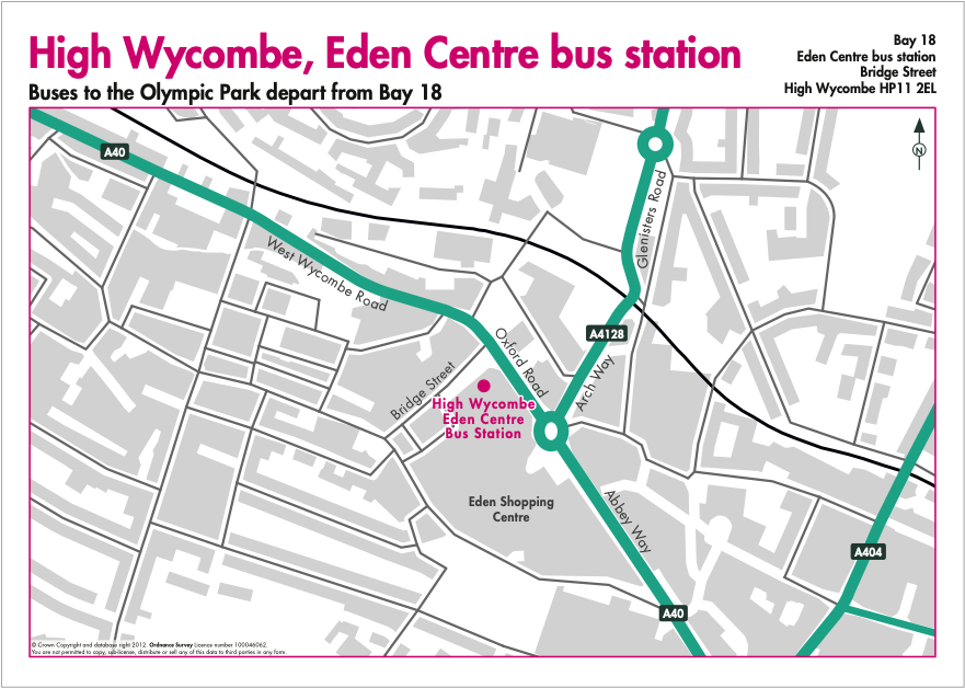
Example: Map for ticket holders - direct coach map from High Wycombe to Olympic Park
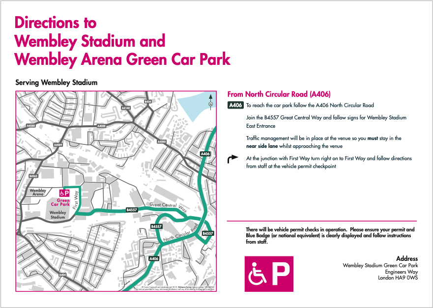
Example: Map for disabled (blue badge holders) - parking for Wembley Stadium/Arena venues
Rugby World Cup - United Kingdon 2015
Maps for all 13 venues were originated with different maps for various stakeholders including spectators, workforce/deliveries, press/broadcasters and local road restrictions for residents. There were also seating plans for each venue, route mapping for each team to relevant venues and posters showing spectator/fan zones and shuttle buses to the venue.
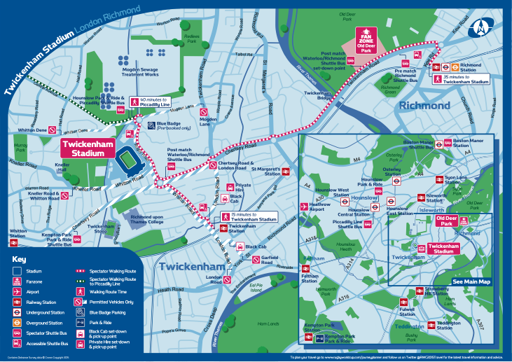
Twickenham Stadium - spectator map
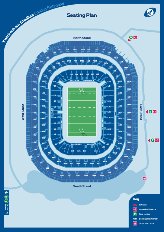
Twickenham Stadium - seating plan
European Games (Multisport) - Baku 2015
Maps for 13 different venues were originated. All entrances and designated areas were required to be shown for different stakeholders within and around the venues. There was also a requirement to show all levels within the buildings.
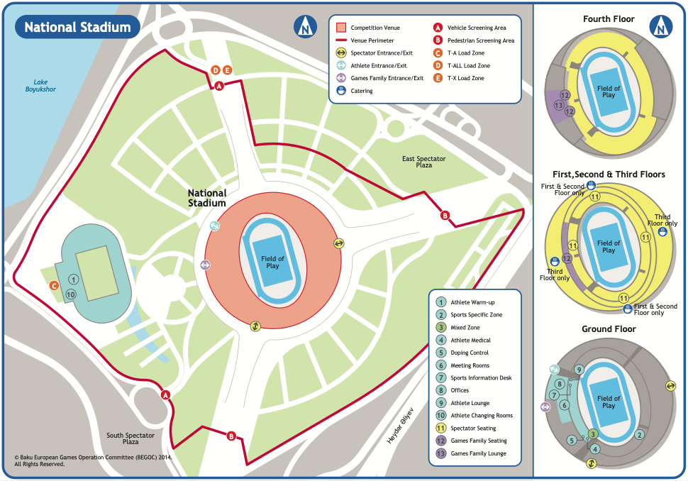
National Stadium
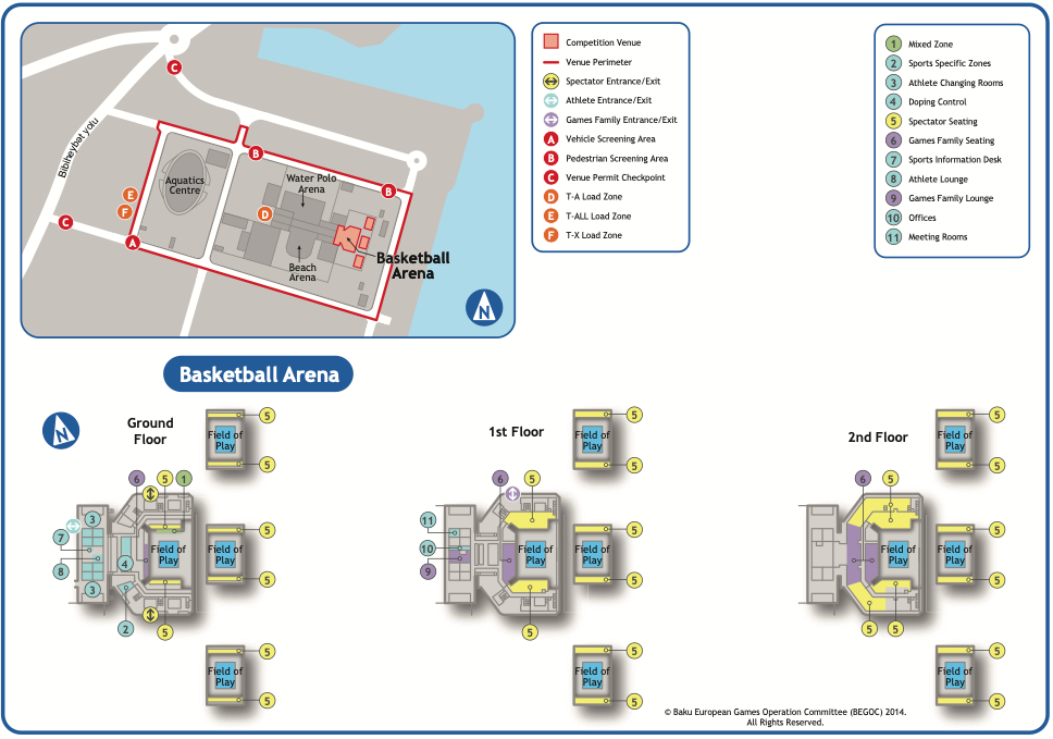
Basketball Arena
Birmingham 2022 Commonwealth Games
Pindar Creative worked with the Transport for West Midlands Commonwealth Games Team to produce a series of public-facing engagement maps.
The maps were produced to highlight the impact on local roads for residents during the event. The maps confirmed roads with no or limited vehicle access, where there were changes to traffic conditions and roads with permit access only.
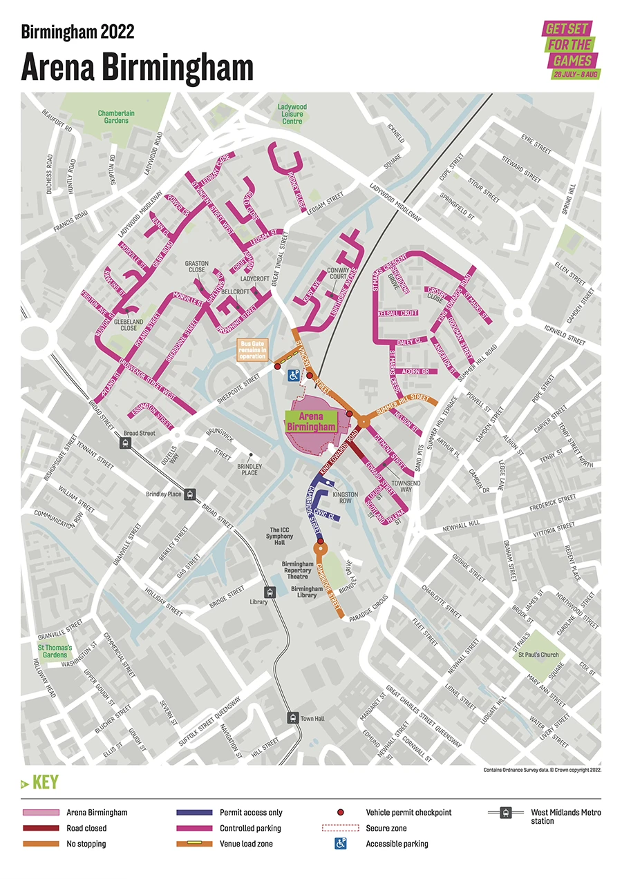
Example: map highlighting controlled parking and access around the Arena
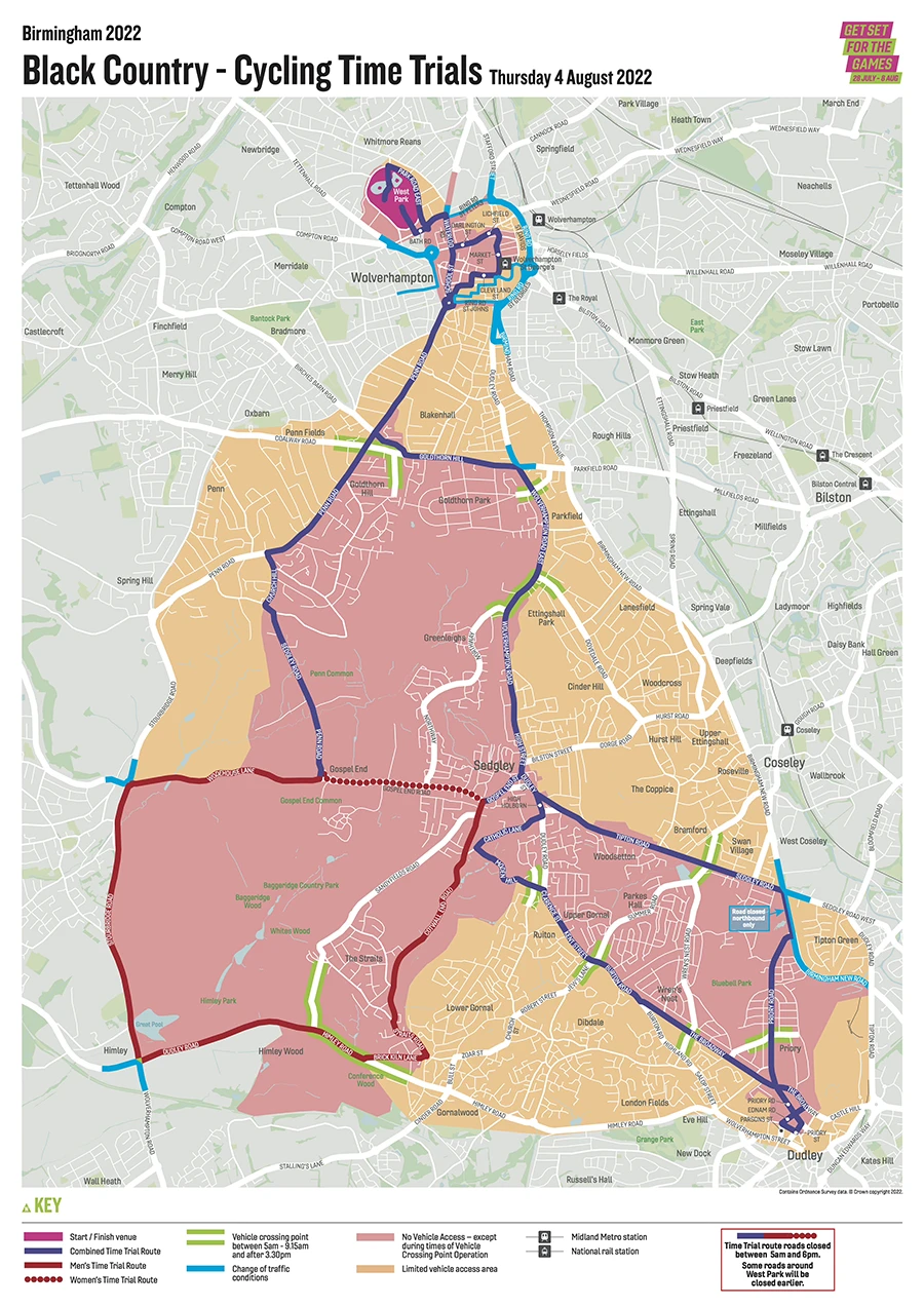
Example: map highlighting vehicle access during the Cycling Time Trials
3D Buildings
Illustrations of key buildings can be included as 3D elements to help people who struggle to read maps, including those who may have learning difficulties. They provide a literal representation of key landmarks and make the maps more intuitive. Buildings can be shown 'north-facing on conventional mapping but can also be rotated to the correct angle for 'heads up' mapping, which means they are orientated to face the same way as the user is facing. This helps people understand their immediate environment more easily. Pindar Creative can provide 3D stadium images for your project.
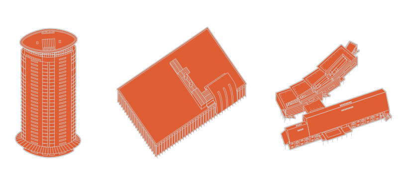
Examples of 3D buildings created by Pindar Creative for Swansea wayfinding mapping
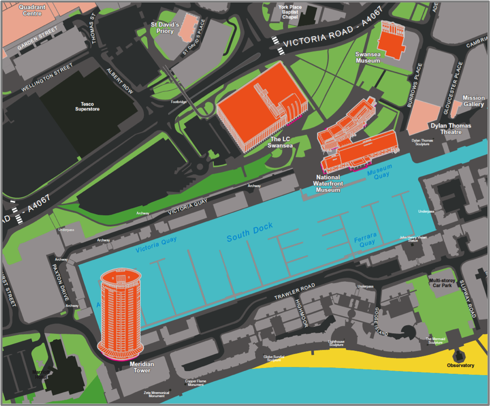
3D buildings in situ on Swansea wayfinding mapping