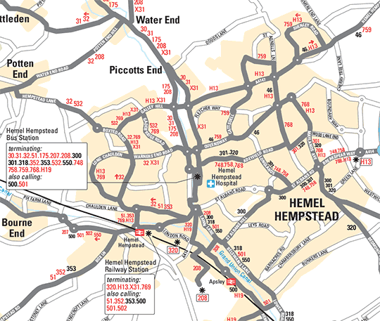
In conjunction with Hertfordshire County Council, Pindar Creative has produced a new look series of Bus Guides to cover the entire network within the County. A series of three more detailed maps replaced the previous traditional style single County Map.
Original style map
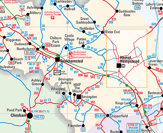
The new style maps were created using GIS mapping software, making use of OS OpenData for the whole county of Hertfordshire. The county level map was produced using 'Meridian2' data and the individual towns using 'Vectormap' District.
This enabled the maps to be drawn accurately and at a much greater scale, with bus routes shown on named roads. To speed production the bus routes were also supplied to Pindar Creative as ‘shape files' from the Councils HAPS database, reducing the need for them to supply manually marked up copy.
The maps clearly show the urban areas, and major roads are highlighted to help the user navigate their way around each area. Also because the maps were drawn using GIS, this helped reduce the time and therefore cost to produce the cartography, thus aiding the Council's decison to replace their existing dated publication.
New Style