Following the success of the Sustainable Travel Transition Year Fund (STTYF) programme, and as part of its ongoing legacy, Go Smarter continues to offer a range of resources to encourage active and sustainable travel.
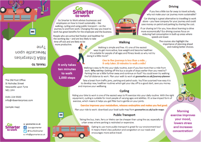
In 2017, Go Smarter asked Pindar Creative to create a resource that would enable schools, businesses and local communities in the North East Combined Authority area to produce their own leaflets featuring a site-specific map.
This resource will:
- Make use of Go Smarter's established and well-recognised brand
- Use a free, consistent source of mapping
- Enable some level of personalisation
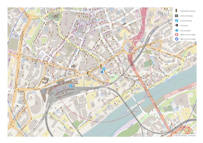
- Include 'isochrones' to indicate walking times to the site
- Be free to use
Pindar Creative built an intuitive mapping portal that allows users to choose one of four templates (primary school; secondary school; business; community) providing useful information on active and sustainable travel. The templates can be personalised with site names and some supplementary information.
Users can choose from three layers of OpenStreetMap data, highlighting cycling and transportation links, and can include up to two isochrones to indicate walking times from their site. Symbols can be dragged and dropped onto the leaflet to highlight cycle parking, local crossings, and no parking zones.
Once happy with the finished leaflet, users can download a PDF for use on their website, or print to their home or office printer. Alternatively, the PDF can be sent to us if professionally printed and folded leaflets are required*.
The portal enables anyone in the North East Combined Authority region to access this mapping resource.
How to access your map
Visit https://gosmarter.pindarcreative.co.uk and enter a valid postcode to make your own map.

