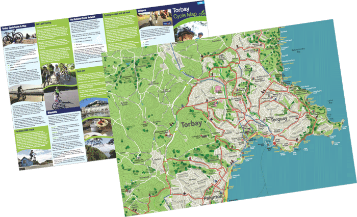
Commissioned by Torbay Council in 2015 the cycle map is intended for use for both local residents and for the many tourists visiting the area each year with the intention of exploring by bike. The map has been drawn in a semi-pictorial style with use of graphics to help make it attractive and make the experience of reading the mapping appealing.
Highlights are as follows:
- A set of 4 easy-to-follow, colour-coded, themed lunchtime walks of 20-60 minutes
- Distance is shown in the key in both time and minutes, making it easy to understand
- Fun symbols depict a range of people cycling along the routes
- POIs use fun, self-explanatory symbols that are appealing to both children and adults
- Clear and simple colour-coding shows on- and off-road cycle routes, ensuring cyclists know what to expect
- Ferry terminals/stations are clearly depicted to encourage multi-modal travel
- Clear information on the reverse, explains that different rail operators have differing cycle carriage policies
- Cover image shows parent and child enjoying cycling; this helps to normalize cycling as an everyday activity and shows that it is accessible to families
- The text explains how to enjoy cycling safely, and talks about beginners/young/ old/learner/experienced cyclists; this helps normalize cycling as an activity for all and encourages those new to cycling to 'give it a go'
- The text uses simple language to explain what the signs you may see while cycling mean
- The reverse provides clear information on ‘Bikeability’ and shows that Torbay Council is also able to provide adult and child 'Learn to Ride' lessons, or cycle training for adults to build confidence
- Local cycling amenities (BMX track/Velopark) are highlighted for those who want to try something different.