New Glasgow Cycle Map launched to coincide with European Championships 2018
05 September 2018
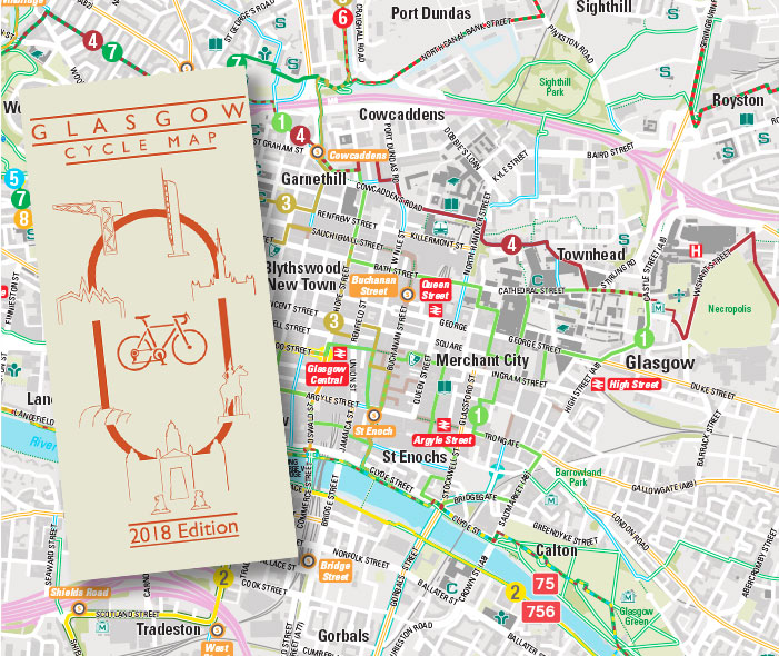
Commissioned by Glasgow City Council in 2018, the new Glasgow Cycle Map has been designed to appeal to local residents and the many visitors that Glasgow attracts each year. Its launch coincided with the European Championships held in Glasgow in August 2018 with the hope that the event would see an uplift in cycling locally. More than 10,000 copies were given away during the event.
Cycle routes are helpfully grouped into traffic-free 'Category 1 Routes' that will appeal to less experienced cyclists, and 'Category 2 Routes' for cyclists who are happy to ride on shared-use routes. Recreational cycle facilities (BMX, mountain bike) are clearly depicted as well as rail stations and the foot ferry at Ferry Green to encourage multi-modal travel.
The map includes eight recommended routes ranging from a leisurely 12km 'Murals Trail' which starts at a Nextbike hire station making it ideal for visitors, to a more taxing 53km loop exploring the Seven Locks and Clyde. The routes, developed by renowned cycle touring guru Markus Stitz, are described on the reverse of the map and usefully categorised by difficulty. The route descriptions, along with .gpx files, can also be found at www.smartertravelGLA.co.uk