Pindar Creative delivers new seamless cycle map for City of Edinburgh Council
31 March 2026
Pindar Creative has produced a new cycle map for the City of Edinburgh Council after being appointed through a competitive tender process.
Creating a Single, Future-Ready Map Base
The Council’s previous cycle maps had been produced as eight separate A3 sheets and had not been updated for some time. Maintaining multiple overlapping map files can make updates more complex and time-consuming, so the brief included creating a single seamless base covering the entire network.
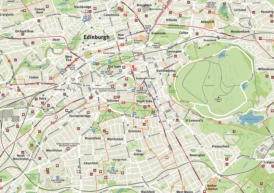
This is an approach we always advocate. Maintaining one master map makes ongoing updates much simpler and ensures consistency across the whole network. It also means the mapping is optimised for digital use in the future, for example, if an interactive mapping website is developed.
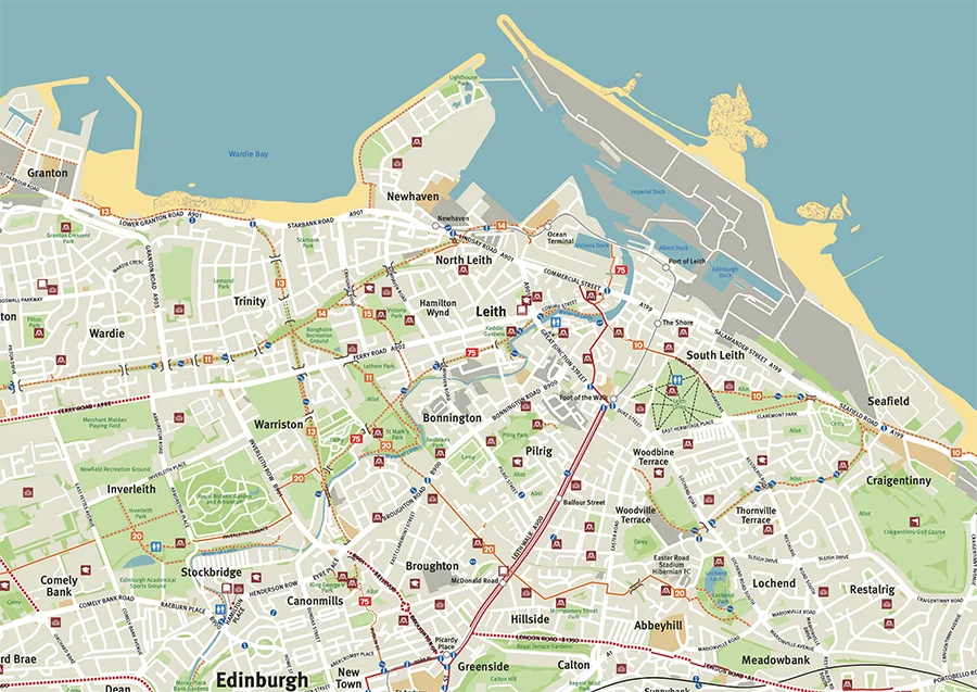
We also recommended producing the new mapping at a 1:20,000 scale, compared with the previous maps, which were at approximately 1:25,000. The slightly larger scale improves legibility and allows key cycling information to be presented more clearly. Alongside this, we worked collaboratively with the Council to remove some less essential content from the base mapping, helping create a cleaner and more accessible map that is easier for users to read while navigating.
Auditing 184km of the Network


As part of the project, 184km of the cycle network was audited to verify routes and identify updates. For this stage, we worked with Markus Stitz, with whom we have collaborated on several projects.
Markus is based in Edinburgh and is a well-known endurance cyclist and bikepacking advocate who has developed several long-distance cycling routes across Scotland. He is also the founder of Edinburgh’s popular Dawn Patrol rides, which encourage more people to get out cycling in the early hours and experience the city in a different way. In addition to his cycling work, Markus is an acclaimed photographer and videographer, and his latest book, Gravel Rides Edinburgh, Fife & The Lothians, includes several rides in and around the city, making him an ideal partner for this project. During the network audit, he also captured a range of photographs along the routes, which have been made available to the Council for use in the leaflet artwork.
Printed Map Recommendations
Although the network was created as a single seamless base, we recommended splitting the content into five A2 printed maps. The larger A2 format allows each map to show more coverage than the previous A3 maps, while remaining economical to print and easy for users to handle while out cycling.
We also proposed the recommended geographic coverage for each of the five maps to ensure clear and logical divisions across the network.
The Council will be producing the leaflet artwork, using the new base mapping as the foundation for the printed maps.
Jill Tinsley, Commercial Director at Pindar Creative, said:
 It was great working with the team at the City of Edinburgh Council on this project. They had clearly thought through what they wanted to achieve with the new mapping and had a strong vision of making it as useful and accessible as possible for a wide range of users. It was also great to work with Markus again. He always brings added value to projects like this, alongside a huge depth of cycling knowledge and insight.
