Wayfinding signs for London’s newest landmark ‘Chelsea Quay’
7 May 2026
New wayfinding signs and public realm improvements have been recently introduced at Chelsea Quay, part of the Tideway project along the Thames. This initiative is focused on reconnecting the river with the surrounding community. The site includes new intertidal terraces and public spaces, offering places for retreat and leisure, enhanced with artwork and improved pedestrian access.
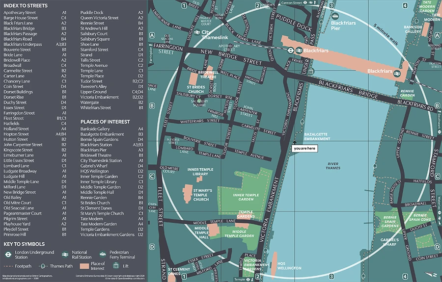
As part of this project, new wayfinding maps were required at Chelsea Quay to guide visitors through the newly developed riverside spaces, helping visitors connect with the Thames and highlight the changing water levels.
The team at Oxford Cartographers were chosen to manage this aspect of the project due to their extensive experience in developing high-quality wayfinding solutions for complex environments. They are experts in creating clear, user-friendly designs and can customise maps for different environments.
The detailed heads-up mapping includes places of interest within a 5-minute walk and the location of transport links including the nearest national rail station, ferry terminals and access to the Thames Path walkway.
The signage has been carefully integrated to complement the tactile and visual elements of the site, further enhancing the public's interaction with the space and the river.
Bridget Sawyers, Tideway,
 These new maps and signs serve not only practical purposes but also enhance the aesthetic experience, contributing to the overall transformation of the Chelsea Embankment into a place of retreat and reflection.

The Princess Royal, Princess Anne, visited Chelsea Quay to mark the opening of the newly developed public space as part of the Tideway project. The event highlighted the significance of the Tideway project in improving the River Thames, both environmentally and as a public amenity. Princess Anne's visit underscored the importance of such developments in enhancing urban spaces and promoting sustainability in London.