Cycle Map for Barnsley
4 September 2026
Pindar Creative worked with Barnsley Metropolitan Borough Council to produce a cycle map for the borough, giving residents a clear, easy-to-use guide to cycling routes from Penistone and Holmfirth in the west, through to Goldthorpe and the Dearne Valley in the east.
The map distinguishes between on-road cycle routes, traffic-free cycleways, bridleways and footpaths, alongside a network of Arterial Routes and Principal Town Connections linking towns such as Royston, Wombwell, Cudworth, Penistone and Hoyland into Barnsley Bike Works. Detailed inset maps of Barnsley town centre and Wharncliffe Woods offer extra clarity in the busiest parts of the route network, while National Cycle Network route numbers, car parking, cafés, cycle shops, leisure centres and libraries are marked throughout.
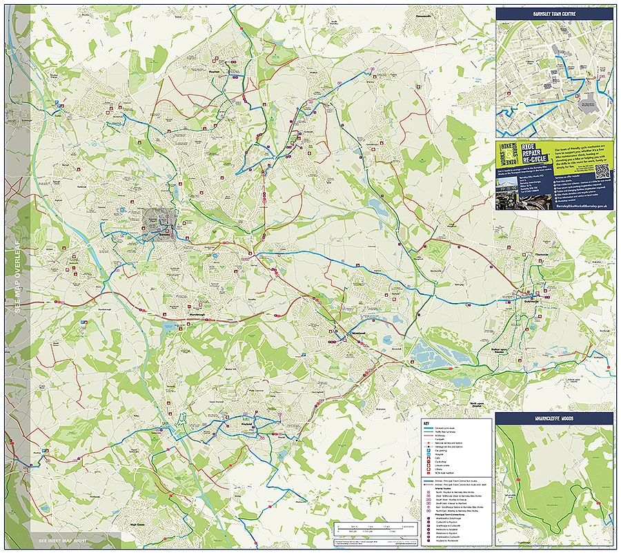
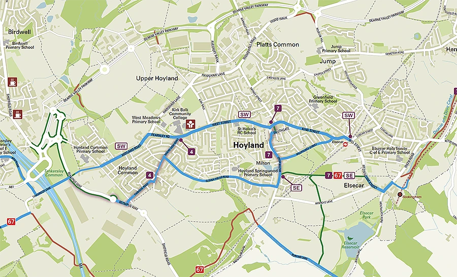
The map supports Barnsley Council's wider commitment to cycling, working alongside Barnsley Bike Works and the council's Sport and Physical Activity team. Barnsley Bike Works runs a mobile cycle repair service across the community, in workplaces and schools, operates a workshop at Barnsley Interchange, and loans e-bikes to residents for up to a month at a time, helping more people try cycling.
Barnsley has a real mix of terrain for cyclists, from steep Pennine lanes to flatter routes through the Dearne Valley, and Pindar Creative relished the challenge of capturing it clearly at every scale. It's a project the team is proud to have brought to life, and one more step towards making cycling a realistic choice for more people across the borough.