Updating your Cycle and Walking Map Resources
5 May 2020
We might only be able to do one form of exercise each day at the moment, but when things get back to normal I’m sure we will all be keen to cycle and walk more. So, now might be as good a time as ever to look at updating your map resources. We’d like to share a couple of recent projects with you.
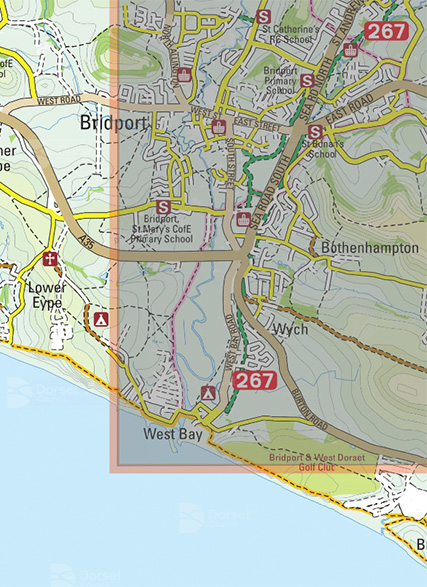
The first is a sustainable travel map produced for Dorset County Council highlighting walking and cycle routes in and around Bridport. A scale and time/distance bars help make distances easy to understand, and contours and hill-shading indicate terrain and gradients. The map will be available online as an interactive map shortly.
The second is a new cycle map for Greener Kirkcaldy, a community-led charity working locally to benefit people and the environment. The map highlights three commuter routes and three leisure routes to encourage people to give cycling a try.
The third is a series of six cycling and walking maps for Transport for West Midlands, promoting the green corridor between Wolverhampton and Birmingham.
Finally, we’ve recreated two maps for Argyll & Bute Council highlighting walking and cycle routes in and around Oban and the Isle of Bute. A scale and time/distance bars help make distances easy to understand, and hill-shading indicate terrain and gradients.
We work in partnership with a wide range of organisations to support their active and sustainable travel initiatives by delivering cost-effective solutions that make use of royalty-free mapping resources, where possible. Our highly-trained cartographers can assist with new commissions and updates to existing map resources. We also offer a range of interactive mapping solutions